Bourtange border crossing - Summer 2002
Between Bourtange and Neurhede. Here the Dutch N365 changes into the German B401. The Germans left a small monument at the border. I think that's sympathetic.
Sometimes the border is inconspicuous, but not here. First there's the 
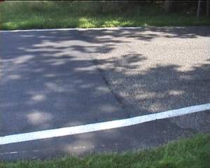
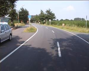
change in road surface as you cross from Germany into the Netherlands. Then there are the country signs

The Dutch sign is a bit more welcoming than the German sign. But the Germans have put up an information billboard, a map, and a picnic table.

They think that the border is an important feature of the landscape - and I agree with them.

This is the view West, into Germany. And this is the view East, into the Netherlands.

There is a border marker on each side of the road and the numbering increases in the Northern direction (this once was the border with the kingdom of Hannover). The Southern side has number 180v. The Northern side has 181i.

The Germans have kept the original barrier that once marked the border crossing. But they have not maintained it. The boom is very rusty and I don't expect that this monument will make it into 2013 - it's 20th birthday.

The border was abandoned in 1993. Before that time you could only cross the border between 6:30 and 22:00.

I wonder if they will celebrate it's 10th anniversary in 2003 ...

This was the former German border station. Now it's a private home. It has been restored nicely. It is immediately clear that you are in Germany. Signs and directions abound. Nature reserve - no camping!
But the only obvious nature that we could see were the hemp fields all around. This is hemp for fibers. You could smoke it, but it has no active ingredients.

We followed a tiny asphalt road along the border until it became an unpaved gravel track. I didn't feel like driving further with my city car.

Here you're standing on the border and looking into German territory. It's a German electricity substation.

The German asphalt road leads West towards the Netherlands and there it changes into a narrow concrete bicycle track. The border is nicely visible in the change of road surface. I have no idea what the letters "EEL" indicate.
Here a bank and a ditch mark the border. It is overgrown with oak and birch trees and it looks very ancient. I don't know it's history, but probably the Germans dug it. The whole landmark is on German territory, as you will see below.

Here you're looking West towards a Dutch canal and maize field. It's an extremely flat landscape all the way to the North Sea.

Walking South along the canal I found the next border marker - 180i. That means that I've missed 3 other border markers.

It's a pity I won't be returning soon. I've grown fond of these little border explorations. Every crossing has it's own unique character and there's always something interesting to see.

I have missed a great opportunity of looking at the borders while they were still active.

Border crossings
Deserted Buildings
Urban Adventure Home